Mark Oprea
On July 17, a month after enduring the biggest flood of his life, Raymond Cole finally opened the floodgates in Prairie du Rocher, Illinois, a bedroom community two miles from the banks of the Mississippi River.
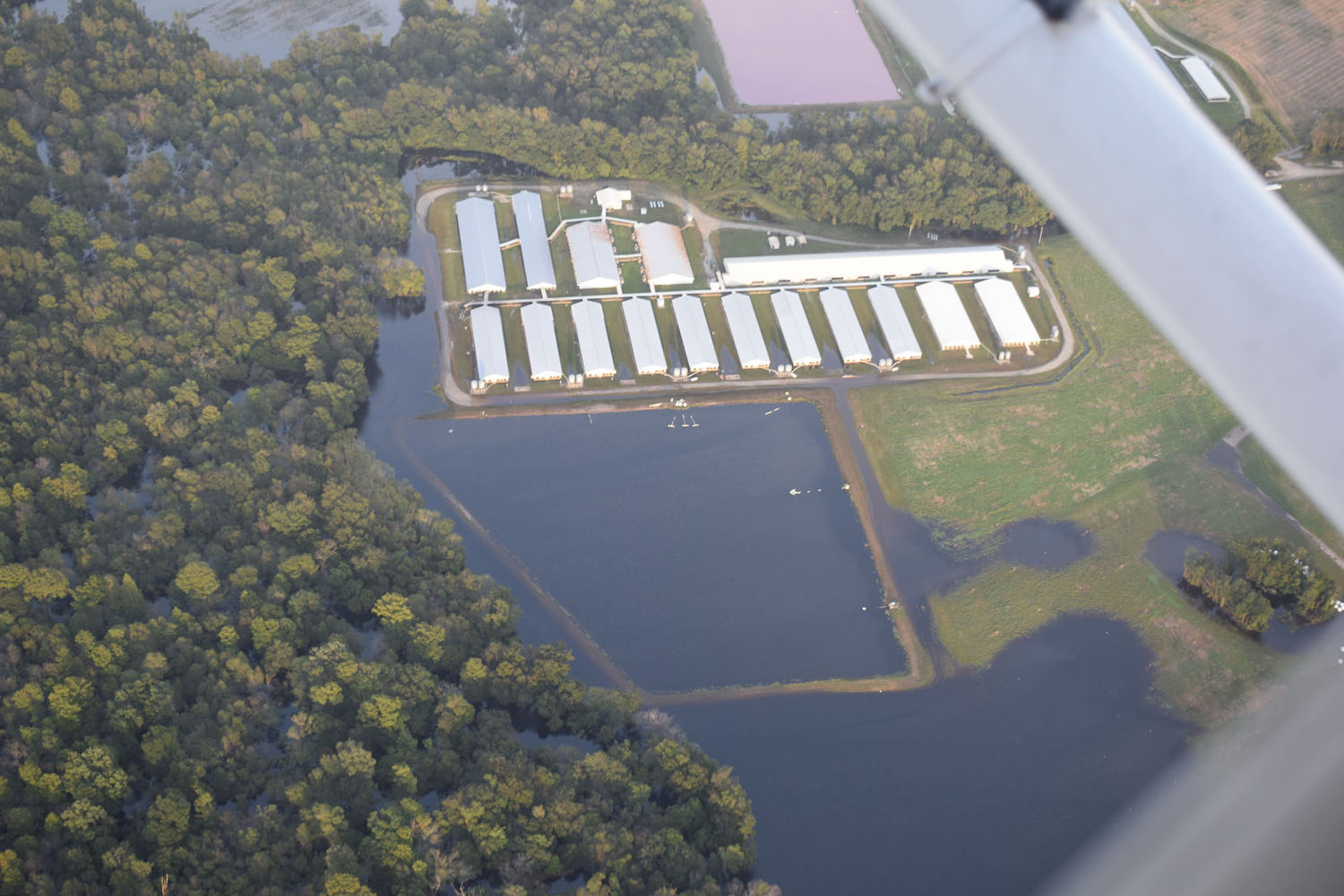
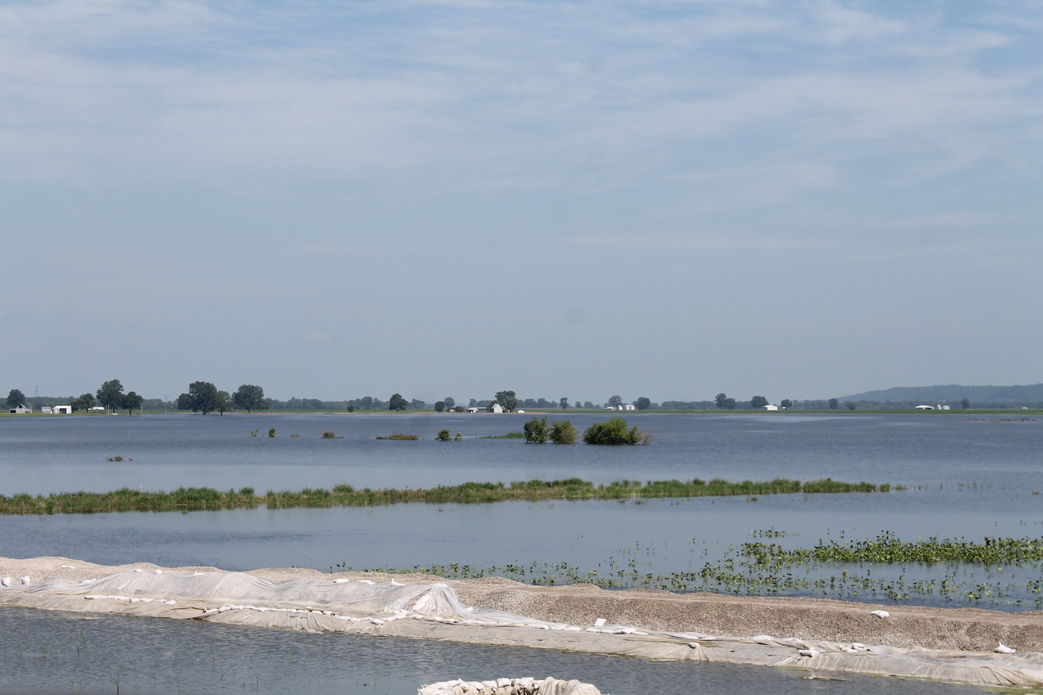
Cole, who is 66 years old, is the town’s volunteer mayor, and it was his job to spearhead the process of draining the water from thousands of acres of submerged farmland. Though sandbaggers had rushed to fortify the levee that safeguards Prairie du Rocher (“Prayree day Row-chur” to locals), the river had crested the inner section of the levee’s 50-foot dual system in late June. River water slowly creeped in. Down south, Highway 3 was cordoned off. A drainage valve broke and needed repair. In a matter of days, roughly 17,000 acres of soy and corn fields was submerged.
“I remember when our parking lot started to flood,” Cole recalled, during an interview just one day after he’d opened the floodgates. He was sitting inside a conference room adjacent to his mayoral office. “It was within two feet of the fertilizer shed, and started to come towards us,” he said. “We worked around the clock, setting up pumps. I’m telling you, these people worked their tails off. There was no luck involved.”
 Mark Oprea
 Raymond Cole, the 66-year-old volunteer mayor of Prairie du Rocher, Ill., stands in front of one-half of his property along the village’s bluffs, on July 18, 2019. . Cole’s home is just outside FEMA’s designated High Risk area. “I’m a farmboy at heart,” he says. “So I know what these boys are going through.”
This year has been the wettest in American history, according to the National Oceanic and Atmospheric Association, prompting farmers across the Midwest to delay planting as many as 20 million acres, another historic outcome of the persistent deluge. And this spring and summer, after months of abnormally heavy precipitation in the Midwest, the levee systems that line the Mississippi River started to breach.
The first disaster proclamation came in mid-March, when Iowa’s Republican Governor, Kim Reynolds, signed a notice due to heavy road flooding in 67 of the state’s 99 counties. By April, sandbaggers were scrambling to protect their town of Hannibal, Missouri, when the river rose above the 49-inch levee marking. In May, the Mississippi crested over the riverside town of Davenport, Iowa, and ran out into the streets in a matter of hours. Thirty other levees tumbled soon after—part of a wave of destruction that would go on to impact nearly 14 million American lives from North Dakota to Louisiana. All told, more than 100 major flood events—hundreds of instances where levees likely failed—were tracked between January and June by the U.S. Geological Survey, according to The New York Times.
 Mark Oprea
 A sandbag depository in the center of Prairie du Rocher, Ill., on July 18, 2019. Rocher Mayor Raymond Cole led sandbagging efforts in June with the help of dozens of village townsfolk
Government rules and private insurance protocols suggest that continuing to farm in the levees’ shadows might be folly. Trouble is, doing so is still for many a matter of economic necessity. They have to farm. Although there’s been 25 years of vast policy changes and technological advances since the Great Flood of 1993, the Midwest’s worst on record, this year’s catastrophe still has had dire effects. Some in Illinois are taking trucker jobs; others are selling their farms and relocating to Missouri for tax purposes. “When you’re a farmer and you’re in your 50s or 60s, it’s hard to find a job somewhere else,” Steve Gonzalez, of Gonzalez Farms in Prairie du Rocher, said. “You’re in this struggle, trying to make do with what you’ve got.”
Although there’s been 25 years of vast policy changes and technological advances since the Great Flood of 1993, pictured above, the Midwest’s worst on record, this year’s catastrophe still has had dire effects
But some farmers say that this mandate leaves them with an impossible choice: give up and pay prohibitively expensive insurance premiums, or pay the ultimate penalty and vacate the only land they’ve ever called home.
* * *
ocher’s top-of-the-line dual system was constructed a few years after the Great Flood of 1927, the first time the U.S. government stepped in to bolster Midwestern farmers with floodways and levees. After Hurricane Katrina devastated New Orleans in 2005, a financially-stressed Federal Emergency Management Agency (FEMA) suddenly altered Rocher’s levee status from “certified” to “provisionally-certified,” essentially disqualifying the village from federal disaster funds—a reclassification that would eventually put many local farmers in a higher, more expensive risk bracket with insurers.
In 2009, Rocher submitted a completed study proving its levee system’s efficacy, with the help of the Army Corps of Engineers. It was rejected: There were “deficiencies,” FEMA said, due to a gross under-seepage problem that leads to mini volcanoes of rising air pressure farmers call sand boils. Cole helped install dozens of gravity drains—buckets that release built-up air pressure—along the outer levee lines, but to little federal recognition. “They think the boils will move the soil out,” Cole says now, “and the levee will collapse.”
 Mark Oprea
 The sight of Bluff Road north of Prairie du Rocher, Ill, on July 18, 2019. This summer’s flooding cut off road access to the Flood Basin for several months
“That’s why they want us de-certified,” Cole said. “Because if we’re not certified, and this thing blows from under-seepage, then they can wash their hands.” Cole suggested that insurance premiums could increase up to ten percent every year. “Basically,” he added, “you’re looking at flood insurance being about the same as your house payment.” (Out of the 210 all insurable structures FEMA identified in 2017, only 46 are under contract thus far.)
But the question remains: Who should pay when a levee fails: the government responsible for the well-being of civilians, or the farmers who farm perilously close to the water’s edge?
* * *
he problem with levee accreditation is that it is both expensive and required by federal law. Since 1986, FEMA has used Title 44 of the Code of Federal Regulations to underline a handful of strict qualifications that every one of Illinois’ 137 levee districts must meet to receive federal funding, from how structurally stable their embankments are during base floods, to “wave effects” and post-flood erosion.
According to Cassie Ringdorf, a representative of FEMA Region V, FEMA did request such composite proof data from the Prairie Du Rocher-Modoc Levee District after a countywide map update of Randolph County in 2005. Rocher officials signed the “provisional” agreement, promising hard data “within two years.” Fourteen years later, according to Ringdorf, no progress has been made.
“As of September 2019,” Ringdorf wrote in an email, “FEMA has still not received the data required to meet the [accreditation standards], and is only able to map the risks associated with the levee based on the data provided.” How to explain the revisions that have already been made to flood maps? Ringdorf wrote that such updates are meant merely to accommodate “the nature of flood risk changes over time”—suggesting that, without data from Rocher to show otherwise, the government’s assessment should stand.
Over at the Illinois Farm Bureau, which represents three out of every four farmers across the state, Kirby Wagner, the Bureau’s assistant director of transportation and government, said he believed that although 2019’s Great Flood did not directly spike insurance premiums, such region-wide disasters do make levee accreditation all the more difficult. Because state funds are relatively limited—especially those dispersed by the Illinois Emergency Management Agency—responsibility for bolstering, repairing, and surveying a district’s system is ultimately in the lap of the levee commissioner. Landowners, Wagner said, therefore have two options before the system is up to par: deal with high-risk premiums, or relocate altogether.
 Mark Oprea
 The entrance, and inner levee, to the Illinois village of Prairie du Rocher, on July 18, 2019. Nearly all Rocher’s 270 property owners have been hit this year with rising flood insurance premium hikes
Although Cole is far removed from the farming life these days, his heart readily goes out to those still in the profession during times of agricultural tragedy. Born and raised in Solon, Iowa, he labored on his father’s 140-acre farm for 12 years until his father died when Cole was 18. As interest rates skyrocketed in the 1980s, Cole abandoned farm work for decades in recycling and dredging bodies of water everywhere from Southern California to the Boston Harbor. In 1995, he met a professor in St. Louis, and the two relocated to her home high on the floodplain on Bluff Road. About four years ago Cole took the $400-a-month mayor gig, he said, “because no one else wanted to do it.”
Cole’s role places him in the middle of two opposing forces. On one side, villagers and farmers who can’t afford insurance premiums; on the other, federal officials who urge him to push townsfolk to buy them under pressure.
Yet, “nothing has changed since 2004,” Cole said. “Everything that we’ve got is still working, and still the same. We’ve never failed.”
To prove his point, Cole took us out in the middle of July on an hour-long tour through Rocher, going west on Levee Road. As soon as we passed through the floodgates into the farmland, a wholly disparate world opened up into view: miles upon miles of stunning countryside spotted with lake-sized sheets of flood water. “Normally you don’t have water lilies growing out in the middle of your field,” Cole said, matter-of-factly, as we drove. White hurons and black vultures flew over browned wheat and halved power pylons, an image that seemed to extend ad infinitum. It was a sight deceptively serene: The flood has cost Rocher’s farmers millions of dollars in clean-up and crop losses.
As Cole drove down the outer levee, we saw a downed ferry behind sunken river birches and silver maples. He pointed out several points that had cracked in 1993, others where sand boils had been attacked by gravity drains to decompress the pressure build-up under the earth. We stopped the car right before Fish Lake Road. To our right was the Mississippi, risen 20 feet up to the outer levee. To our left, a field of soy half-submerged in stillness. A barge had been brought here. Extra sandbagging done there.
I asked Cole what it felt like to have been so close—a foot away—from devastation had Rocher’s inner levee actually broken in June. He looked left, toward the bluffs.
“Oh, it would flood the whole valley,” he said. As we exited the outer levee gravel road, he added, “And don’t forget. It’s like this all across the Midwest.”
* * *
ven when strong precautious have been taken, major floods can sometimes shatter all expectations. For the Hawkins family, who live near the village of Valmeyer, Illinois, a 30-minute drive northwest of Rocher, that moment came in 1993—a year that began like any other. Nearly three decades later, after a headquarters move and countless dollars in crop loss, the Hawkins family now talks about the Great Flood as their fulcrum moment: the event that changed their lives indefinitely.
By the time the February snows had subsided that year, Peep-Hawk Farms, spearheaded by 78-year-old Ellery Hawkins, had properly amassed the corn and soy planting regimen for the coming summer. As usual, Ellery had winter wheat stored in grain silos set to be distributed around the state of Illinois. Valmeyer, where Ellery’s grandfather had settled in the 19th century, had seen unusually large amounts of snowfall, which extended into early March of 1993. Then, the snow melted. Constant rainfall pummeled the Flood Basin, extending into early July. The Mississippi River, which flows roughly two miles south of the Hawkins’s home at the time, rose to 46 feet a week before August.
That year, talk around Valmeyer, an agriculture community set along the flood plains that run in a curve from Cairo, Illinois to St. Louis, Missouri, was mostly skeptical. Sure, there had been a sizeable flood scare back in 1973, when the rain brought the Mississippi five or six feet from the Hawkins’s own dual-levee system, but no one suffered any major crop loss, “just flooded roads at different spots.” Twenty years later, the Hawkins family and the town believed it’d just be a repeat. Nothing to fret about.
“Not one of us had any idea,” Hawkins, a congenial patriarch with a high-pitched rural drawl, says. “It was kinda funny, actually. Right before that weekend—or that Saturday actually—our neighbor Rick said, ‘Oh, we’ll never flood, we’ll never flood.’ And, well, look what happened.”
Ellery and his wife had already done the best they could when the Mississippi breached the outside levee. They had relocated furniture, tractors, and farming equipment to a relative’s home higher up in the state, in Waterloo, and decided to remain there, despite FEMA’s mandatory order of evacuation. Then, Ellery’s uncle and Peep-Hawk namesake, Sylvester Piepers, died from complications after a quadruple bypass, and an impromptu burial took place as storms swept into the region. That Sunday morning, the north levee broke. Within hours, river water descended upon Valmeyer, swallowing cars, felling trees, covering corn and soy fields in a flat span of grey-blue.
“We had about six feet of water in our house by the end of the day,” says Adele, now 76 years old. “Right to the bottom of our lights in the dining room.”
Photos taken in the aftermath show a third of the Hawkins home under the Mississippi. A basketball hoop half gone. A 14-year-old Garrett boating with father Ellery through the front door, moving out carpet and upstairs bedding. After all, almost immediately after the levees broke and submerged Valmeyer, the Hawkins knew they had two decisions post-flood. They could allow FEMA to buy out the two-story colonial Ellery had built by hand; that, or move their home, where six people had lived and grown up. It turns out that the whole town—nearly 1,200 people—was planning to do the latter: relocate nearly 250 families onto the elevated bluffs, miles up the road.
 Mark Oprea
 Garrett Hawkins, 39, of Peep-Hawk Farms, drives along the inner levee outside Peep-Hawk’s new location higher on the floodplain, on July 18, 2019. Due to the road closures, for months Hawkins could access his own home a mile away onlyby boat
Despite losing the entirety of their 1,900-acre crop base—and thousands of dollars in projected yield—the Hawkins family prepared to truck away their property by the time the floodplain dried in mid-September. The result was a Catch-22. Both abandoning their house and keeping it would have driven the Hawkinses even further into debt. Ellery says that nearly every other property owner in Valmeyer at the time had sold his or her home in FEMA’s developing $100 million Buyout Program, and moved elsewhere, or into federal trailers up north in Columbia (collectively called “FEMAville” at the time).
By then, Ellery had already hired a local structure moving company—which can cost up to $150,000 for just a few miles of travel—and set a spot four miles up the floodplain to resituate Peep-Hawk. Drywall came down. Carpet was ripped out by Ellery’s daughters (“Oh god, there was fuzz flying up everywhere around the room!”). FEMA had covered his neighbors’ costs of relocation, he’d thought, so why not theirs?
“I kept on back and forth with the government people” before that spring, Ellery says. “And they said, ‘Go get some competitive bids, and give us the lowest one.’”
“And we’re like, ‘There aren’t that many people who move houses,’” Garrett, who is now 39, says. “And they said, ‘Well, you should’ve done that beforehand. How can we buy something that isn’t even there?’ Long story short, we ended up not getting a cent.”
“There’s a lot of farmers attached to their land,” Ellery adds. “And that’s where their farm is. If we didn’t have this land….”
“Then we probably wouldn’t have built it where it was,” Garrett says.
 Mark Oprea
 Garrett Hawkins, 39, of Peep-Hawk Farms, displays the family’s photo album of the Great Flood of ’93, in their home in Valmeyer, Ill., on July 18, 2019. It was such a significant event in our lives,” he says. “You wouldn’t believe how often we’ll be talking about something, and say, ‘Was that before the flood or after the flood?’”
* * *
t was July 18, the day to finally open the valves at the Hawkins farm, and although one-quarter of their property was still under the Mississippi, it was a good day. “Good,” because there was no crop loss. And yet, because of the flooding in June, Garrett hadn’t been able to get to his home in nearly a month.
“It was very close to happening all over again for us,” Garrett said, sitting at the table in his family’s dining room—the same room they’d evacuated during the 1993 flood. Across from where he sat were markings on the wall before the foyer. They were markings of years past. “This time our levee got up to 18 inches of breaching. I suppose we just got fortunate this year it didn’t.”
“Oh, it was scary,” Adele said.
“Let’s just say it brought back a lot of memories,” Ellery added.
Besides losing 25 percent of their farm to water (“several hundred acres,” they estimated), Garrett said that this year’s flood had moved back production only one or two months at best, a monetary loss that would be fully assessed by the end of the year’s yield. Still, fluctuations in market rates could offset those losses for Peep-Hawk by the end of 2020. “I mean, our crops don’t look that bad, considering that the rest of July and August will dictate what’s gonna happen,” he said. “It’s gonna be hot this week, ya know?”
Before Garrett and Ellery headed out to loosen the valves, effectively beginning the gradual process of moving seepage from one side to the other (“The Mississippi goes down a lot slower than it rises,” Ellery said), the men drove south on Bluff to where their old house used to be. We slowed down at a section of levee space where, if one squinted hard enough, one could see all of the property and land that the Hawkins had ever known.
We headed back to the new farm up the road, and the sight was identical to that down in Rocher: stark beauty despite devastation. I asked the Hawkins why they weren’t as forlorn as they had been in 1993, why the whole day I hadn’t heard a tinge of farmer’s lament. As the sight of the bluffs—all expansive and sunlit green—came into view, Garrett laughed quickly, like he expected the question to pop up.
“You have to remember we’re all at the mercy of Mother Nature,” he said. “Just like the old saying goes, ‘A farmer must be an optimist or he wouldn’t be a farmer after all.’”


