EWG
On Wednesday, the advocacy and research organizations Environmental Working Group and Waterkeeper Alliance released a series of interactive GIS maps of large-scale poultry, pork, and cattle operations in North Carolina, giving Tar Heels an unprecedented look at the impact of industrial animal agriculture on their environment.
North Carolina is home to thousands of Concentrated Animal Feeding Operations (CAFOs), farms that confine large numbers of animals at high density, usually indoors. CAFO producers tend to farm under contract with big meatpackers–which, in North Carolina, means Cargill for poultry and Smithfield for swine. For more on the complicated political and social dynamics surrounding the state’s large-scale livestock farms, Quartz has a good explainer.

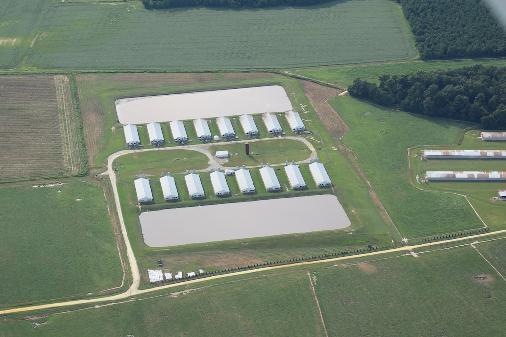
CAFOs in North Carolina. Pink dots represent swine; yellow are poultry; purple are cattle. Click on images for full map.
The interactive mapping project is notable in part because it’s the first time the locations of more than 3,900 poultry operations have been made accessible to the public. North Carolina’s current poultry population exceeds its human counterpart at a ratio of 20 to 1.
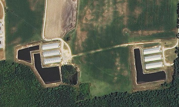
 EWG
EWG Duplin County is the top hog-producing county in the nation. Above, census data and CAFO locations
The locations of hog operations were already publicly accessible, but specific details on the precise shape and size of manure lagoons that dapple the rural North Carolina landscape were difficult to pin down. Those details are now available, in addition to estimates on each farm’s barn count, animal count, waste output, agricultural land within one mile, and waste application rate in pounds per acre.
That the information is easily at hand, though, doesn’t make its details easier to swallow.
 Environmental Working Group
 “When I started, we knew we had them [CAFOs], but we had a list of one or two dozen,” said Catawba Riverkeeper Sam Perkins, in a press conference on Tuesday. “To date, we have about a thousand poultry houses in my basin in North Carolina alone.”
One map segments farms by watershed. The report notes that 170 farms are positioned within the state’s floodplain.
“Hundreds of poultry CAFO houses are suffocating watersheds with an overabundance of nutrients,” said Perkins. An overabundance of nutrients can lead to fish kills and cause harm to human and livestock infants.
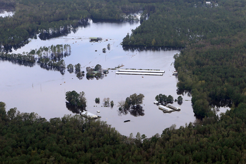
 EWG
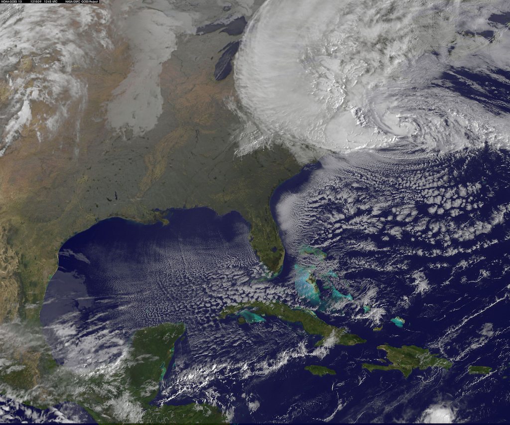
EWG Some of the farms and lagoons are located within floodplains
The maps’ Google Earth-like viewing layer provides hundreds of full-color photos of enormous manure lagoons. The repositories seem to dwarf the barns they serve.
As the report puts it: “The more animals you have, the more waste you have to deal with.” View the full project here.